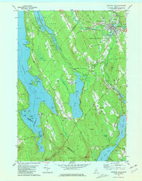
1981 Map of Mechanic Falls
USGS Topo · Published 1981About this map
Mechanic Falls serves as the industrial and residential hub of this 1981 survey, where the Little Androscoggin River and the Canadian National railroad intersect. The map illustrates a landscape of working timberland and water resources, featuring a series of large water bodies including Tripp Pond and the Upper Range Pond, Middle Range Pond, and Lower Range Pond chain. To the west, the shoreline of Thompson Lake is dotted with seasonal camps and landings such as Hayes Cove and Lunt Point.
Find a feature on this map
105 named features on this map. Tap any name to fly to it.
Don’t see what you’re looking for? This feature index may not catch every label — zoom into the map to look around manually.
Map Details
Editions of this 1981 Mechanic Falls Map
This is the sole edition of this map. No revisions or reprints were ever made.
Other maps of this area

1894 · Gray
USGS Topo · 1:62,500

1896 · Norway
USGS Topo · 1:62,500

1896 · Sebago
USGS Topo · 1:62,500

1898 · Gray
USGS Topo · 1:62,500

1908 · Poland
USGS Topo · 1:62,500

1940 · Poland
USGS Topo · 1:62,500

1942 · Poland
USGS Topo · 1:62,500

1942 · Gray
USGS Topo · 1:62,500

1942 · Sebago Lake
USGS Topo · 1:62,500

1943 · Sebago Lake
USGS Topo · 1:62,500