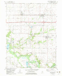
1982 Map of Mechanicsburg
USGS Topo · Published 1983About this map
Mechanicsburg sits at the heart of this East Central Illinois landscape, where the agricultural grid is punctuated by the infrastructure of the local energy and transport sectors. The Illinois Terminal and Western railroad tracks cut a straight path through the northern half of the quadrangle, serving the grain-rich communities of Dawson and Buffalo. Further south, the extraction economy is visible through the Mechanicsburg Oil Field and Roby West Oil Field, which occupy the lands between Clear Creek and the Sangamon River.
Find a feature on this map
37 named features on this map. Tap any name to fly to it.
Don’t see what you’re looking for? This feature index may not catch every label — zoom into the map to look around manually.
Map Details
Editions of this 1982 Mechanicsburg Map
This is the sole edition of this map. No revisions or reprints were ever made.
Other maps of this area

1907 · Springfield
USGS Topo · 1:62,500

1922 · Divernon
USGS Topo · 1:62,500

1923 · Taylorville
USGS Topo · 1:62,500

1924 · Divernon
USGS Topo · 1:62,500

1925 · Taylorville
USGS Topo · 1:62,500

1930 · Springfield
USGS Topo · 1:62,500

1940 · Springfield
USGS Topo · 1:62,500

1950 · Springfield East
USGS Topo · 1:24,000

1954 · Mechanicsburg
USGS Topo · 1:62,500

1958 · Decatur
USGS Topo · 1:250,000