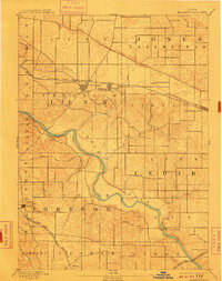
1891 Map of Mechanicsville
USGS Topo · Published 1891About this map
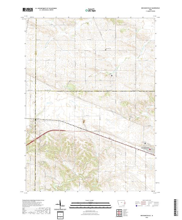
The Cedar River cuts a winding path through the heart of the eastern Iowa prairie, serving as a primary geographic anchor for these nineteenth-century townships. This 1887 survey, published in 1891, documents the early expansion of the rail network across Linn, Cedar, and Johnson counties. The Chicago and North Western Railroad bridges the northern prairie, connecting the bustling villages of Mt. Vernon, Lisbon, and Mechanicsville. To the southwest, the Burlington Cedar Rapids and Northern R. R. follows a different trajectory, passing through the smaller settlement of Morse and skirting the edge of Solon. The map reveals a landscape defined by the transition from river-bottom woodlands to organized agricultural plots, with the steep banks of Cedar Bluffs offering a rare topographical deviation from the surrounding farmsteads.
Find a feature on this map
21 named features on this map. Tap any name to fly to it.
Don’t see what you’re looking for? This feature index may not catch every label — zoom into the map to look around manually.
Map Details
Editions of this 1891 Mechanicsville Map
This is the sole edition of this map. No revisions or reprints were ever made.
Historical Maps of Mount Vernon Through Time
8 maps found