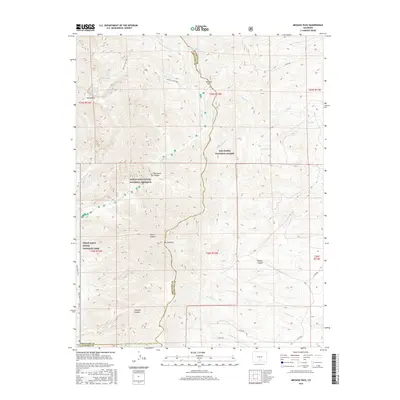
2016 Map of Medano Pass
USGS Topo · Published 2016About this map
The high Sangre de Cristo Mountains define this landscape, where the Saguache, Huerfano, and Alamosa county lines meet at the continental divide. Medano Pass serves as a critical geographic notch between the peaks, providing a historic route through the range. The map illustrates a complex hydrologic network including Hudson Ditch, Medano Ditch, and Medano Cr, alongside high-altitude features like Medano Lake and the McKinley Clay Reservoir.
Find a feature on this map
40 named features on this map. Tap any name to fly to it.
Don’t see what you’re looking for? This feature index may not catch every label — zoom into the map to look around manually.
Map Details
Editions of this 2016 Medano Pass Map
This is the sole edition of this map. No revisions or reprints were ever made.
Other maps of this area

1889 · Huerfano Park
USGS Topo · 1:125,000

1892 · Huerfano Park
USGS Topo · 1:125,000

1954 · Trinidad
USGS Topo · 1:250,000

1955 · Trinidad
USGS Topo · 1:250,000

1958 · Trinidad
USGS Topo · 1:250,000

1959 · Trinidad
USGS Topo · 1:250,000
1960 · Beck Mountain
USGS Topo · 1:24,000
1960 · Devils Gulch
USGS Topo · 1:24,000

1965 · Zapata Ranch
USGS Topo · 1:24,000

1967 · Mosca Pass
USGS Topo · 1:24,000