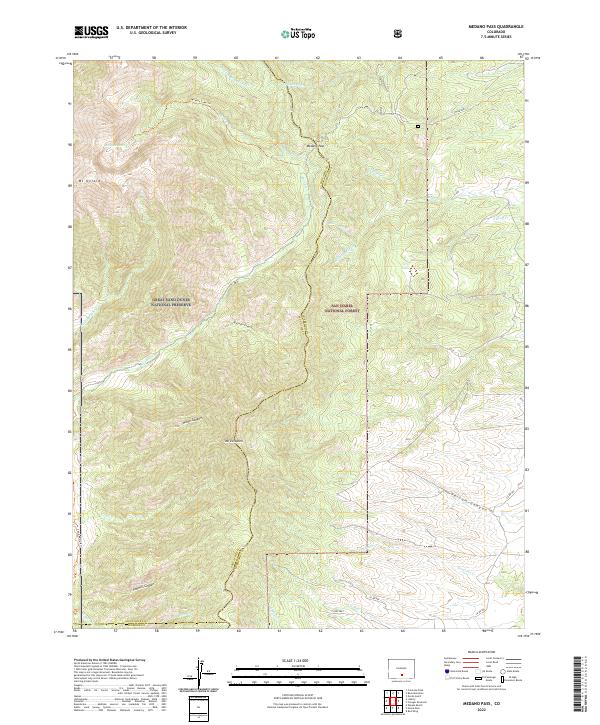
2022 Map of Medano Pass
USGS Topo · Published 2022About this map
Medano Pass serves as a critical geographic divide where the Saguache and Huerfano county lines meet amidst the high peaks of southern Colorado. This 2022 survey details a landscape defined by the transition from the Great Sand Dunes National Preserve in the west to the dense timber of the San Isabel National Forest in the east. The terrain is marked by significant elevation changes, anchored by Mt Herard and Mt Zwischen, with numerous drainages like Medano Cr and Pantleon Cr carving deep canyons through the uplift. Infrastructure in this area is limited to rugged routes such as Co RD 559 and the Medano Lake Trl, which provides access to the high-alpine Medano Lake. Historically significant water management features like the Hudson Ditch and Medano Ditch reflect the ongoing efforts to divert mountain runoff for use in the drier lowlands.
Find a feature on this map
39 named features on this map. Tap any name to fly to it.
Don’t see what you’re looking for? This feature index may not catch every label — zoom into the map to look around manually.
Map Details
Editions of this 2022 Medano Pass Map
This is the sole edition of this map. No revisions or reprints were ever made.
Other maps of this area

1889 · Huerfano Park
USGS Topo · 1:125,000

1892 · Huerfano Park
USGS Topo · 1:125,000

1954 · Trinidad
USGS Topo · 1:250,000

1955 · Trinidad
USGS Topo · 1:250,000

1958 · Trinidad
USGS Topo · 1:250,000

1959 · Trinidad
USGS Topo · 1:250,000
1960 · Beck Mountain
USGS Topo · 1:24,000
1960 · Devils Gulch
USGS Topo · 1:24,000

1965 · Zapata Ranch
USGS Topo · 1:24,000

1967 · Mosca Pass
USGS Topo · 1:24,000