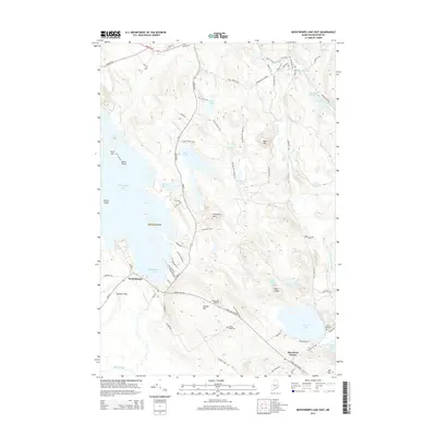
2014 Map of Meddybemps Lake East
USGS Topo · Published 2014About this map
Meddybemps and the rural junction of Blanchard Corner anchor this landscape of glacial lakes and flowage basins in Washington County. The area is defined by a complex hydrology where Meddybemps Lake feeds the Dennys River, while smaller bodies like Bearce Lake and James Pond are interspersed between granite uplands. Named peaks such as Bald Mtn and Porcupine Mtn rise above the wetlands, overlooking an extensive network of fire and access trails including the Greenway Trail and Raven Trail.
Find a feature on this map
78 named features on this map. Tap any name to fly to it.
Don’t see what you’re looking for? This feature index may not catch every label — zoom into the map to look around manually.
Map Details
Editions of this 2014 Meddybemps Lake East Map
This is the sole edition of this map. No revisions or reprints were ever made.
Other maps of this area

1907 · Eastport
USGS Topo · 1:48,000

1908 · Eastport
USGS Topo · 1:62,500

1929 · Calais
USGS Topo · 1:48,000

1929 · Robbinston
USGS Topo · 1:48,000

1931 · Robbinston
USGS Topo · 1:62,500

1932 · Calais
USGS Topo · 1:62,500

1941 · Gardner Lake
USGS Topo · 1:62,500

1943 · Gardner Lake
USGS Topo · 1:62,500

1943 · Eastport
USGS Topo · 1:62,500

1945 · Eastport
USGS Topo · 1:62,500