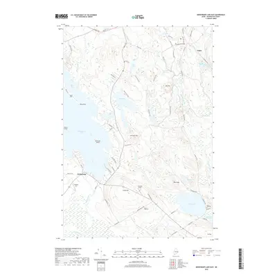
2018 Map of Meddybemps Lake East
USGS Topo · Published 2018About this map
The eastern shores of Meddybemps Lake and the rural fringes of Calais define this landscape in Washington County. This region is characterized by a complex network of waterways, including the headwaters of the Dennys River and the expansive Pennamaquan River Reservoir near the southern boundary. Significant elevation changes are marked by Bald Mtn and Porcupine Mtn, while local transport is facilitated by an intricate system of trails such as the Mullen Trail and Greenway Trail. Settlement patterns are concentrated around the village of Meddybemps, with regional aviation activity represented by Gillespie Field and the Flying Ed Airport. For local historians and genealogists, the map identifies small, significant landmarks like Damon Ridge Cem and Round Pond Cem, which sit amidst the hills and flowages that have shaped the township's layout for generations.
Find a feature on this map
66 named features on this map. Tap any name to fly to it.
Don’t see what you’re looking for? This feature index may not catch every label — zoom into the map to look around manually.
Map Details
Editions of this 2018 Meddybemps Lake East Map
This is the sole edition of this map. No revisions or reprints were ever made.
Other maps of this area

1907 · Eastport
USGS Topo · 1:48,000

1908 · Eastport
USGS Topo · 1:62,500

1929 · Calais
USGS Topo · 1:48,000

1929 · Robbinston
USGS Topo · 1:48,000

1931 · Robbinston
USGS Topo · 1:62,500

1932 · Calais
USGS Topo · 1:62,500

1941 · Gardner Lake
USGS Topo · 1:62,500

1943 · Gardner Lake
USGS Topo · 1:62,500

1943 · Eastport
USGS Topo · 1:62,500

1945 · Eastport
USGS Topo · 1:62,500