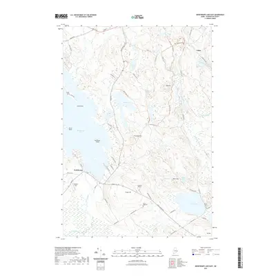
2021 Map of Meddybemps Lake East
USGS Topo · Published 2021About this map
Meddybemps Lake dominates the western half of this Maine landscape, where the settlement of Meddybemps sits at the outlet of the Dennys River. The terrain is defined by a series of low peaks and ridges, including Porcupine Mtn, Bald Mtn, and Conant Hill, interspersed with an intricate network of wetlands like Snare Meadow and Goodall Heath. This modern survey illustrates a quiet, well-connected interior of Washington County, where traditional roads like Airline Rd and Baring Rd meet an extensive network of specialized tracks such as Mullen Trl and Raven Trl. Aviation interests are represented by Gillespie Field and the curiously named Flying Ed Airport. Local history and genealogy are anchored by established sites like Damon Ridge Cem near Round Lake and Round Pond Cem further east near the Calais border.
Find a feature on this map
70 named features on this map. Tap any name to fly to it.
Don’t see what you’re looking for? This feature index may not catch every label — zoom into the map to look around manually.
Map Details
Editions of this 2021 Meddybemps Lake East Map
This is the sole edition of this map. No revisions or reprints were ever made.
Other maps of this area

1907 · Eastport
USGS Topo · 1:48,000

1908 · Eastport
USGS Topo · 1:62,500

1929 · Calais
USGS Topo · 1:48,000

1929 · Robbinston
USGS Topo · 1:48,000

1931 · Robbinston
USGS Topo · 1:62,500

1932 · Calais
USGS Topo · 1:62,500

1941 · Gardner Lake
USGS Topo · 1:62,500

1943 · Gardner Lake
USGS Topo · 1:62,500

1943 · Eastport
USGS Topo · 1:62,500

1945 · Eastport
USGS Topo · 1:62,500