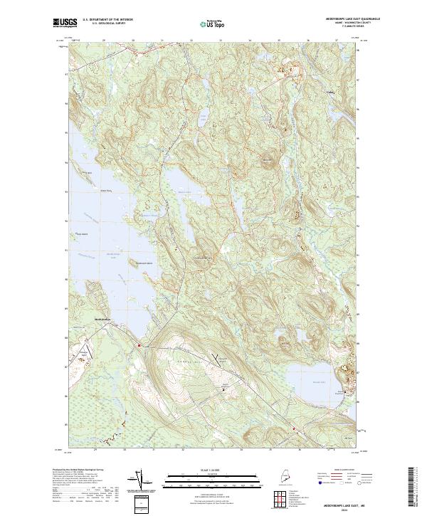
2024 Map of Meddybemps Lake East
USGS Topo · Published 2024About this map
Moosehorn National Wildlife Refuge dominates this section of Washington County, preserving a complex of wetlands and highlands like Porcupine Mtn and Bald Mtn. The landscape is defined by the flow of water through Bearce Lake and the Dennys River, which feeds into the larger Meddybemps Lake at the village of Meddybemps. Historically significant road corridors like Airline Rd and Houlton Rd intersect at the northern boundary, marking long-established transport routes through the Maine woods. Local aviation history is represented by Gillespie Field and the curiously named Flying Ed Airport. For genealogists, the map identifies several burial sites, including Damon Ridge Cem and Round Pond Cem, providing precise locations for family research in this sparsely populated interior.
Find a feature on this map
79 named features on this map. Tap any name to fly to it.
Don’t see what you’re looking for? This feature index may not catch every label — zoom into the map to look around manually.
Map Details
Editions of this 2024 Meddybemps Lake East Map
This is the sole edition of this map. No revisions or reprints were ever made.
Other maps of this area

1907 · Eastport
USGS Topo · 1:48,000

1908 · Eastport
USGS Topo · 1:62,500

1929 · Calais
USGS Topo · 1:48,000

1929 · Robbinston
USGS Topo · 1:48,000

1931 · Robbinston
USGS Topo · 1:62,500

1932 · Calais
USGS Topo · 1:62,500

1941 · Gardner Lake
USGS Topo · 1:62,500

1943 · Gardner Lake
USGS Topo · 1:62,500

1943 · Eastport
USGS Topo · 1:62,500

1945 · Eastport
USGS Topo · 1:62,500