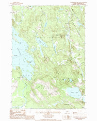
1987 Map of Meddybemps Lake East
USGS Topo · Published 1988About this map
Meddybemps Lake dominates this portion of Washington County, its intricate shoreline punctuated by Eaton Point, Hardwood Island, and a Pier at the village of Meddybemps. The landscape transitions from the open waters of the lake to the dense wetlands and woodlands of the Moosehorn National Wildlife Refuge, which covers much of the eastern terrain. Significant water bodies like Bearce Lake, Round Lake, and Pennamaquan Lake are interconnected by a network of smaller streams and marshes, including Dead Str and the headwaters of the Dennys River.
Find a feature on this map
37 named features on this map. Tap any name to fly to it.
Don’t see what you’re looking for? This feature index may not catch every label — zoom into the map to look around manually.
Map Details
Editions of this 1987 Meddybemps Lake East Map
This is the sole edition of this map. No revisions or reprints were ever made.
Other maps of this area

1907 · Eastport
USGS Topo · 1:48,000

1908 · Eastport
USGS Topo · 1:62,500

1929 · Calais
USGS Topo · 1:48,000

1929 · Robbinston
USGS Topo · 1:48,000

1931 · Robbinston
USGS Topo · 1:62,500

1932 · Calais
USGS Topo · 1:62,500

1941 · Gardner Lake
USGS Topo · 1:62,500

1943 · Gardner Lake
USGS Topo · 1:62,500

1943 · Eastport
USGS Topo · 1:62,500

1945 · Eastport
USGS Topo · 1:62,500