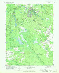
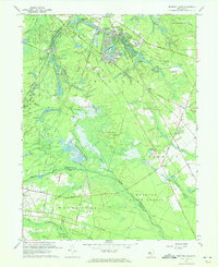
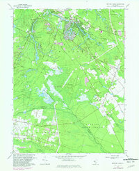
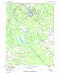
1967 Map of Medford Lakes
USGS Topo · Published 1968About this map
The Wharton State Forest dominates the southern landscape of this mid-century survey, showcasing the unique hydrology and agricultural patterns of the New Jersey Pine Barrens. The map reveals an intricate network of waterways including the Mullica River, Atsionka Branch, and Indian Mills Brook, which supported numerous Cranberry Bogs and the sprawling West Jersey Cranberry Meadows. These features point to the region's long-standing reliance on specialized wetland agriculture.
Find a feature on this map
70 named features on this map. Tap any name to fly to it.
Don’t see what you’re looking for? This feature index may not catch every label — zoom into the map to look around manually.
Map Details
Editions of this 1967 Medford Lakes Map
4 editions found
Other maps of this area

1888 · Pemberton
USGS Topo · 1:62,500

1888 · Mount Holly
USGS Topo · 1:62,500

1890 · Hammonton
USGS Topo · 1:62,500

1890 · Mullica
USGS Topo · 1:62,500

1894 · Hammonton
USGS Topo · 1:62,500

1894 · Pemberton
USGS Topo · 1:62,500

1894 · Mount Holly
USGS Topo · 1:62,500

1894 · Mullica
USGS Topo · 1:62,500

1898 · Pemberton
USGS Topo · 1:62,500

1898 · Mount Holly
USGS Topo · 1:62,500
Featured Places
- Medford Township, NJ
- Southampton Township, NJ
- Tabernacle Township, NJ
- Waterford Township, NJ
- Shamong Township, NJ