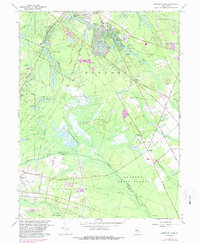
1967 Map of Medford Lakes
USGS Topo · Published 1988About this map
Medford Lakes and its surrounding borough represent a densely clustered residential community defined by its complex network of interconnected waterways. These features, including Upper Aetna Lake and Lake Stockwell, are contrasted by the sprawling wetlands and timberlands of Wharton State Forest to the south. The map documents a specialized agricultural landscape where traditional industries like the West Jersey Cranberry Meadow operate alongside mid-century developments.
Find a feature on this map
74 named features on this map. Tap any name to fly to it.
Don’t see what you’re looking for? This feature index may not catch every label — zoom into the map to look around manually.
Map Details
Editions of this 1967 Medford Lakes Map
4 editions found
Other maps of this area

1888 · Pemberton
USGS Topo · 1:62,500

1888 · Mount Holly
USGS Topo · 1:62,500

1890 · Hammonton
USGS Topo · 1:62,500

1890 · Mullica
USGS Topo · 1:62,500

1894 · Hammonton
USGS Topo · 1:62,500

1894 · Pemberton
USGS Topo · 1:62,500

1894 · Mount Holly
USGS Topo · 1:62,500

1894 · Mullica
USGS Topo · 1:62,500

1898 · Pemberton
USGS Topo · 1:62,500

1898 · Mount Holly
USGS Topo · 1:62,500
Featured Places
- Medford Township, NJ
- Southampton Township, NJ
- Tabernacle Township, NJ
- Waterford Township, NJ
- Shamong Township, NJ