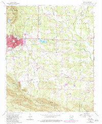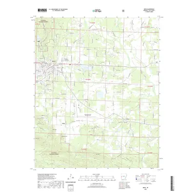
1958 Map of Mena
USGS Topo · Published 1959About this map
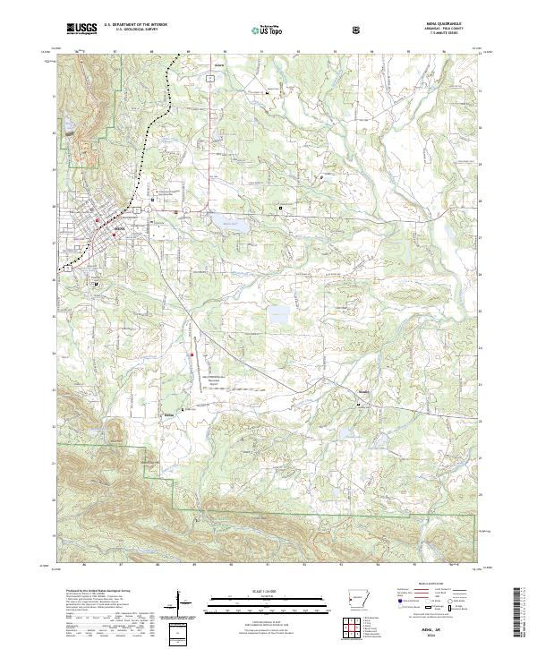
The town of Mena serves as the regional hub at the western edge of the Ouachita National Forest during the late 1950s. The Kansas City Southern Railroad runs north-south through the center of town, connecting it to smaller outlying communities like Acorn and Nunley. This survey captures a landscape defined by mountain ridges and the headwaters of the Ouachita River and Fourche La Fave River. Notable social centers of the era include several country churches such as Union Grove Ch and Holly Springs Ch, while the presence of the Eureka Sch (Abandoned) suggests shifts in the local school system. The Mena Municipal Landing Field sits south of the main settlement, and family history is anchored by sites like Owens Cem and Chant Cem, which are scattered throughout the valleys of the Mill Creek Mountain and Fourche Mountain ranges.
Find a feature on this map
79 named features on this map. Tap any name to fly to it.
Don’t see what you’re looking for? This feature index may not catch every label — zoom into the map to look around manually.
Map Details
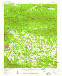
Editions of this 1958 Mena Map
This is the sole edition of this map. No revisions or reprints were ever made.
Historical Maps of Mena Through Time
8 maps found