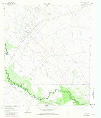
1961 Map of Mentone
USGS Topo · Published 1981About this map
The Mentone townsite serves as the hub for this West Texas landscape, documented during a period of significant petroleum activity in the early 1960s. The map illustrates the sprawling Wheat Oil Field and the Two Freds Oil Field dominating the high ground above the winding Pecos River. Industrial infrastructure like the Porterville Pumping Sta and various pipelines reflect the area's economic focus, while the Atchison Topeka and Santa Fe railroad tracks skirt the river's path through the Texas Bend.
Find a feature on this map
20 named features on this map. Tap any name to fly to it.
Don’t see what you’re looking for? This feature index may not catch every label — zoom into the map to look around manually.
Map Details
Editions of this 1961 Mentone Map
2 editions found
Other maps of this area

1954 · Pecos
USGS Topo · 1:250,000

1957 · Pecos
USGS Topo · 1:250,000

1961 · Soda Lake
USGS Topo · 1:24,000

1961 · Mentone
USGS Topo · 1:24,000

1961 · Anderson Ranch
USGS Topo · 1:24,000

1961 · Lindley Ranch
USGS Topo · 1:24,000

1961 · Sand Lake
USGS Topo · 1:24,000

1967 · Soda Lake NW
USGS Topo · 1:24,000

1968 · Mentone SW
USGS Topo · 1:24,000

1969 · Cheyenne Draw SW
USGS Topo · 1:24,000