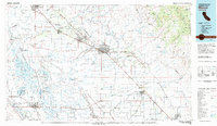
1983 Map of Merced
USGS Topo · Published 1983About this map
Castle Air Force Base stands as a prominent fixture of the San Joaquin Valley landscape in the early 1980s, situated between Atwater and Merced. This era of the Central Valley reveals a complex management of land and water, where the San Joaquin River and Merced River are flanked by an extensive network of conservation areas, including the San Luis National Wildlife Refuge and the Kesterson National Wildlife Refuge. The irrigation infrastructure is highly developed, featuring the California Aqueduct, the Delta-Mendota Canal, and numerous sloughs that supported the agricultural expansion of the region.
Find a feature on this map
124 named features on this map. Tap any name to fly to it.
Don’t see what you’re looking for? This feature index may not catch every label — zoom into the map to look around manually.
Map Details
Editions of this 1983 Merced Map
This is the sole edition of this map. No revisions or reprints were ever made.
Other maps of this area

1893 · Sonora
USGS Topo · 1:125,000

1896 · Sonora
USGS Topo · 1:125,000

1897 · Sonora
USGS Topo · 1:125,000

1897 · Yosemite
USGS Topo · 1:125,000

1898 · Sonora
USGS Topo · 1:125,000

1900 · Yosemite
USGS Topo · 1:125,000

1903 · Yosemite
USGS Topo · 1:125,000

1909 · Yosemite
USGS Topo · 1:125,000

1912 · Mariposa
USGS Topo · 1:125,000

1913 · Dickenson
USGS Topo · 1:31,680