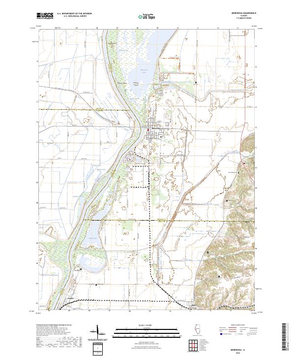
2024 Map of Meredosia
USGS Topo · Published 2024About this map
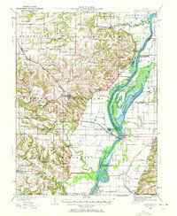
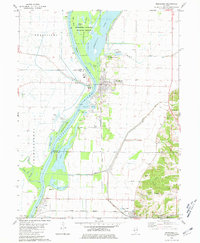
The Meredosia National Wildlife Refuge dominates the northern reaches of this landscape, preserving a complex of wetlands and riverine habitats along the eastern bank of the Illinois River. The interaction between the river and its floodplain is evident in the numerous water bodies such as Meredosia Lake, Smith Lake, and Billings Lake, which are interspersed with landforms like Eagle Island and McGees Island. These features illustrate the shifting hydrology of the area, where backwater lakes and sloughs once defined the local economy and ecology.
Find a feature on this map
89 named features on this map. Tap any name to fly to it.
Don’t see what you’re looking for? This feature index may not catch every label — zoom into the map to look around manually.
Map Details
Editions of this 2024 Meredosia Map
This is the sole edition of this map. No revisions or reprints were ever made.
Historical Maps of Meredosia Through Time
6 maps found