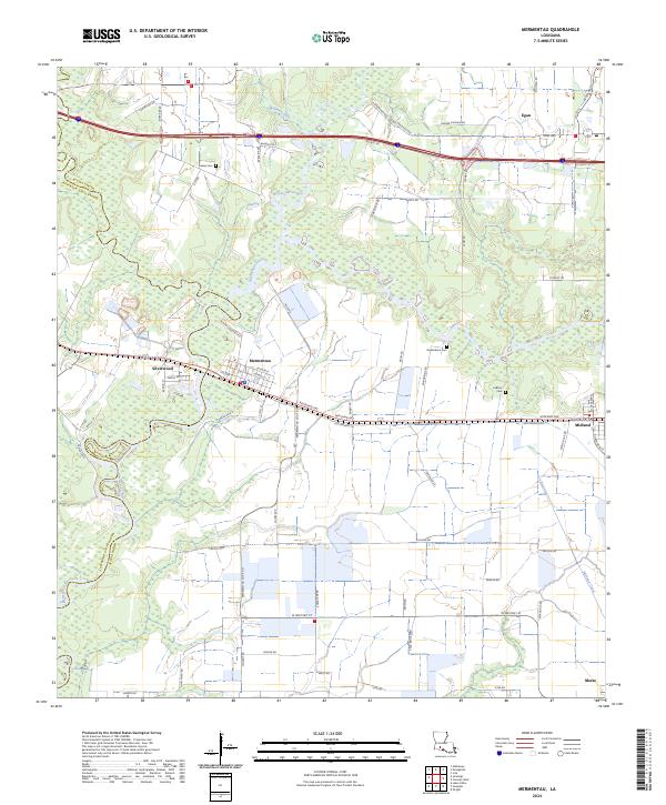
2024 Map of Mermentau
USGS Topo · Published 2024About this map
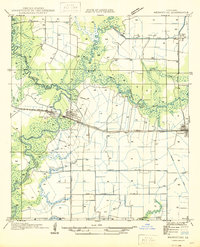
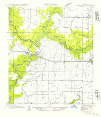
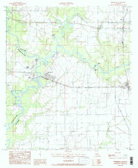
Mermentau and the surrounding Acadia Parish wetlands are defined by a complex network of bayous and man-made waterways. The Mermentau River and Bayou des Cannes anchor the landscape, while the Midland Canal and numerous drainage features reflect the region's agricultural engineering. Settlement is concentrated along the east-west corridor formed by Railroad Ave and the modern interstate, connecting the communities of Egan, Midland, and Silverwood. Local family history is preserved in several burial grounds, including the Indian Cem and Quebodaux Cem. The map illustrates the persistent intersection of natural water systems and rural development, with large tracts of marshland transitioning into structured parish roads. Notable landmarks like Castle Cove and the industrial infrastructure near Port Rd highlight the area's dual character as both a wilderness resource and a transportation hub.
Find a feature on this map
74 named features on this map. Tap any name to fly to it.
Don’t see what you’re looking for? This feature index may not catch every label — zoom into the map to look around manually.
Map Details
Editions of this 2024 Mermentau Map
This is the sole edition of this map. No revisions or reprints were ever made.
Historical Maps of Egan Through Time
4 maps found