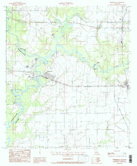
1984 Map of Mermentau
USGS Topo · Published 1985About this map
The Mermentau River and its surrounding wetlands form the heart of this southwest Louisiana landscape, where the confluence of several major bayous shaped early settlement patterns. This mid-1980s survey documents the rural character of the Acadia and Jefferson Davis Parish line, anchored by the town of Mermentau and the community of Midland. The intricate drainage network, including Bayou Nezpique and Bayou Plaquemine Brule, reflects the region's reliance on water for both transport and industry. For genealogists, the map preserves the locations of local burial grounds such as Indian Cem, Quebodaux Cem, and LeBlanc Cem. The infrastructure of the era is evidenced by the L I & M rail line and a Sod Landing Strip, illustrating the blend of traditional river-bayou life with modern aviation and rail transit.
Find a feature on this map
21 named features on this map. Tap any name to fly to it.
Don’t see what you’re looking for? This feature index may not catch every label — zoom into the map to look around manually.
Map Details
Editions of this 1984 Mermentau Map
2 editions found
Other maps of this area

1946 · Morse
USGS Topo · 1:31,680

1946 · Lake Arthur
USGS Topo · 1:31,680

1946 · Mermentau
USGS Topo · 1:31,680

1946 · Jennings
USGS Topo · 1:31,680

1947 · Evangeline
USGS Topo · 1:31,680

1947 · Hathaway
USGS Topo · 1:31,680

1947 · Iota
USGS Topo · 1:31,680

1949 · Gueydan
USGS Topo · 1:31,680

1949 · Estherwood
USGS Topo · 1:31,680

1952 · Lake Charles
USGS Topo · 1:250,000