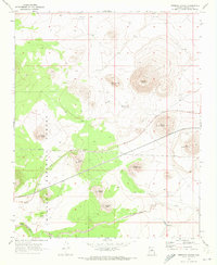
1969 Map of Merriam Crater
USGS Topo · Published 1972About this map
The volcanic cinder cones of the San Francisco volcanic field dominate this 1969 landscape, notably the prominent Merriam Crater and its neighbor The Sproul. Situated within the Coconino National Forest, the map records a high-desert environment defined by geology and sparse infrastructure. Craters are named with geographic and descriptive specificity, including North Sheba Crater, South Sheba Crater, and Junction Crater, often accompanied by nearby pipelines that cut across the terrain.
Find a feature on this map
19 named features on this map. Tap any name to fly to it.
Don’t see what you’re looking for? This feature index may not catch every label — zoom into the map to look around manually.
Map Details
Editions of this 1969 Merriam Crater Map
This is the sole edition of this map. No revisions or reprints were ever made.
Other maps of this area

1886 · San Francisco Mtns
USGS Topo · 1:250,000

1891 · San Francisco Mtns
USGS Topo · 1:250,000

1894 · San Francisco Mtns
USGS Topo · 1:250,000

1899 · San Francisco Mtns
USGS Topo · 1:250,000

1947 · Flagstaff
USGS Topo · 1:250,000

1954 · Flagstaff
USGS Topo · 1:250,000

1958 · Flagstaff
USGS Topo · 1:250,000

1960 · Flagstaff
USGS Topo · 1:250,000

1962 · Flagstaff
USGS Topo · 1:250,000
1968 · Babbitt Wash
USGS Topo · 1:24,000