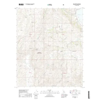
2018 Map of Mesa Grande
USGS Topo · Published 2018About this map
Cleveland National Forest dominates much of this high-elevation landscape in San Diego County, where the San Luis Rey River flows toward Lake Henshaw. The settlement of Mesa Grande sits on a plateau above a complex network of canyons and ridges, including Lusardi Canyon and Quail Canyon. This modern survey reveals a landscape primarily used for ranching and conservation, marked by a series of specialized transit routes like Mesa Truck Trl and Santa Ysabel Truck Trl. Numerous distinct family and ranch holdings are evident through labels such as Loma Madera Ranch Airport, Deming Ranch Rd, and Good Ranch Rd. The terrain is punctuated by significant peaks and valleys, from Angel Mtn and Black Mtn to the open expanses of Adobe Flats and Pamo Valley, illustrating the rugged, undeveloped character of this inland region.
Find a feature on this map
54 named features on this map. Tap any name to fly to it.
Don’t see what you’re looking for? This feature index may not catch every label — zoom into the map to look around manually.
Map Details
Editions of this 2018 Mesa Grande Map
This is the sole edition of this map. No revisions or reprints were ever made.
Other maps of this area

1903 · Ramona
USGS Topo · 1:125,000

1904 · Southern California Sheet No. 2
USGS Topo · 1:250,000

1939 · Warner Springs
USGS Topo · 1:62,500

1939 · Santa Ysabel
USGS Topo · 1:62,500

1939 · Palomar Mountain
USGS Topo · 1:62,500

1942 · Ramona
USGS Topo · 1:62,500

1943 · Santa Ysabel
USGS Topo · 1:62,500

1943 · Warner Springs
USGS Topo · 1:62,500

1947 · Ramona
USGS Topo · 1:62,500

1947 · Santa Ana
USGS Topo · 1:250,000