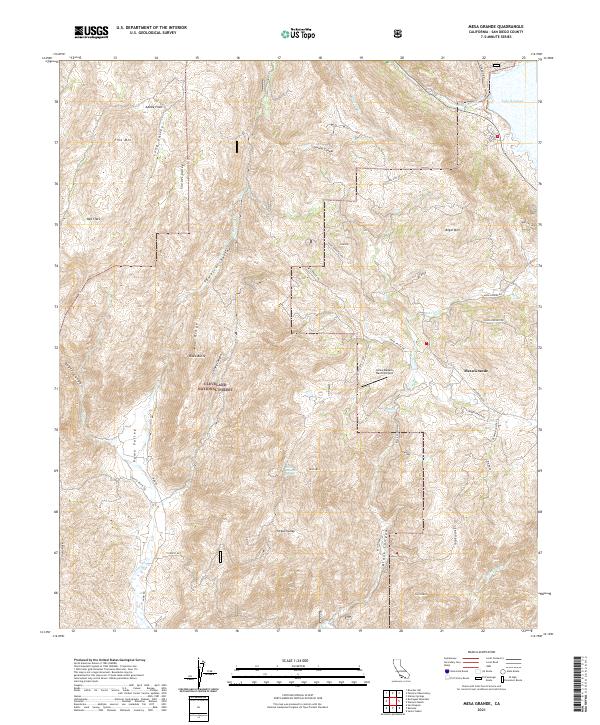
2021 Map of Mesa Grande
USGS Topo · Published 2021About this map
Mesa Grande sits at the heart of this San Diego County upland, where ranching heritage meets the protected lands of the Cleveland National Forest. The landscape is defined by a series of dramatic geographic depressions and rises, including Pamo Valley and Long Valley, separated by prominent features like Mid Ridge and Black Butte. Water is a central element of the terrain, with the San Luis Rey River flowing into the northern reaches near Lake Henshaw. Smaller drainages such as Black Canyon Cr and Temescal Cr carve through the canyons, while Washtub Falls and Black Mountain Spring provide specific points of interest for those studying the hydrology of the region. The map documents an area where remote ranching operations like Loma Madera Ranch/Airport are accessed by winding routes such as Mesa Grande Rd and Guejito Truck Trl.
Find a feature on this map
51 named features on this map. Tap any name to fly to it.
Don’t see what you’re looking for? This feature index may not catch every label — zoom into the map to look around manually.
Map Details
Editions of this 2021 Mesa Grande Map
This is the sole edition of this map. No revisions or reprints were ever made.
Other maps of this area

1903 · Ramona
USGS Topo · 1:125,000

1904 · Southern California Sheet No. 2
USGS Topo · 1:250,000

1939 · Warner Springs
USGS Topo · 1:62,500

1939 · Santa Ysabel
USGS Topo · 1:62,500

1939 · Palomar Mountain
USGS Topo · 1:62,500

1942 · Ramona
USGS Topo · 1:62,500

1943 · Santa Ysabel
USGS Topo · 1:62,500

1943 · Warner Springs
USGS Topo · 1:62,500

1947 · Ramona
USGS Topo · 1:62,500

1947 · Santa Ana
USGS Topo · 1:250,000