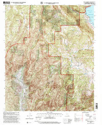
1997 Map of Mesa Grande
USGS Topo · Published 2000About this map
The Mesa Grande Indian Reservation and the sprawling waters of Lake Henshaw anchor this late-twentieth-century study of San Diego County's back country. Situated within the Cleveland National Forest, the landscape is defined by the sharp transition from the Mesa Grande plateau down into the deep basins of Pamo Valley and the Temescal Valley. The map documents a rugged interior economy where old mining claims like the Himalaya Mine, Esmeralda Mine, and Shenandoah Mine dot the slopes of Gem Hill and Angel Mountain.
Find a feature on this map
38 named features on this map. Tap any name to fly to it.
Don’t see what you’re looking for? This feature index may not catch every label — zoom into the map to look around manually.
Map Details
Editions of this 1997 Mesa Grande Map
This is the sole edition of this map. No revisions or reprints were ever made.
Other maps of this area

1903 · Ramona
USGS Topo · 1:125,000

1904 · Southern California Sheet No. 2
USGS Topo · 1:250,000

1939 · Warner Springs
USGS Topo · 1:62,500

1939 · Santa Ysabel
USGS Topo · 1:62,500

1939 · Palomar Mountain
USGS Topo · 1:62,500

1942 · Ramona
USGS Topo · 1:62,500

1943 · Santa Ysabel
USGS Topo · 1:62,500

1943 · Warner Springs
USGS Topo · 1:62,500

1947 · Ramona
USGS Topo · 1:62,500

1947 · Santa Ana
USGS Topo · 1:250,000