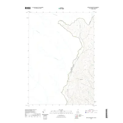
2021 Map of Metallak Mountain
USGS Topo · Published 2021About this map
Metallak Mtn dominates the landscape of this northernmost reach of Coos County, where the terrain forms a sharp natural barrier between the United States and Canada. The US - Canada Border follows the high ridges and the winding course of Halls Stream, a waterway that serves as the primary drainage for numerous smaller tributaries flowing off the mountain slopes. Running parallel to the water, Halls Stream Rd provides the singular terrestrial link through this secluded timberland and mountain pass region. The map captures an intricate network of drainages including Robbers Brook, Graham Brook, and Abbott Brook, which carve the steep eastern face of the mountain. Just across the boundary, Canadian waterways like Rivière Malvina and Rivière Clifton highlight the trans-border geography of the high New England woods.
Find a feature on this map
15 named features on this map. Tap any name to fly to it.
Don’t see what you’re looking for? This feature index may not catch every label — zoom into the map to look around manually.
Map Details
Editions of this 2021 Metallak Mountain Map
This is the sole edition of this map. No revisions or reprints were ever made.
Other maps of this area

1925 · Indian Stream
USGS Topo · 1:48,000

1926 · Indian Stream
USGS Topo · 1:62,500

1927 · Indian Stream
USGS Topo · 1:62,500

1949 · Jackman
USGS Topo · 1:250,000

1963 · Jackman
USGS Topo · 1:250,000

1966 · Sherbrooke
USGS Topo · 1:250,000
1976 · Sherbrooke
USGS Topo · 1:250,000
1986 · Sherbrooke
USGS Topo · 1:100,000
1989 · Pittsburg
USGS Topo · 1:24,000
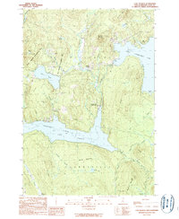
1989 · Lake Francis
USGS Topo · 1:24,000