
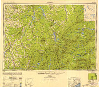
1949 Map of Jackman
USGS Topo · Published 1949About this map
Sherbrooke and the surrounding borderlands of Quebec and Northern Maine are captured here just after the Second World War. This Army Map Service compilation provides a unique perspective on the international boundary, showing how the Canadian Pacific railway and the St Francis River network unified the timber-rich region. The landscape transitions from the industrial centers of East Angus and Lennoxville toward the high peaks of Megantic Mountain and Bigelow Mountain.
Find a feature on this map
86 named features on this map. Tap any name to fly to it.
Don’t see what you’re looking for? This feature index may not catch every label — zoom into the map to look around manually.
Map Details
Editions of this 1949 Jackman Map
2 editions found
Other maps of this area

1903 · Bingham
USGS Topo · 1:62,500

1904 · Anson
USGS Topo · 1:62,500

1905 · Bingham
USGS Topo · 1:62,500

1905 · The Forks
USGS Topo · 1:62,500

1907 · The Forks
USGS Topo · 1:62,500

1919 · Lake Memphremagog
USGS Topo · 1:62,500

1920 · Derby
USGS Topo · 1:62,500

1921 · Brassua Lake
USGS Topo · 1:62,500

1922 · Long Pond
USGS Topo · 1:62,500

1923 · Brassua Lake
USGS Topo · 1:62,500