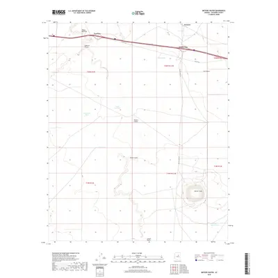
2018 Map of Meteor Crater
USGS Topo · Published 2018About this map
Meteor Crater dominates the southeastern portion of this Coconino County landscape, a profound topographical feature preserved in remarkable detail. The northern edge of the survey is defined by the historic corridor of Old Sixtysix, which parallels the modern interstate. Along this route, small named points like Two Guns, Rimmy Jims, and Sunshine mark the human footprint in an otherwise arid expanse of canyons and draws. The map illustrates a transition from the deep incision of Canyon Diablo in the southwest to the broad plateaus punctuated by livestock water sources such as Prosperity Tank and Horse Pasture Tank. This modern USGS data provides a precise view of the relationship between the legendary Mother Road and the geological landmark that draws visitors to the region, including the access via Meteor Crater Rd.
Find a feature on this map
23 named features on this map. Tap any name to fly to it.
Don’t see what you’re looking for? This feature index may not catch every label — zoom into the map to look around manually.
Map Details
Editions of this 2018 Meteor Crater Map
This is the sole edition of this map. No revisions or reprints were ever made.
Other maps of this area

1883 · Tusayan
USGS Topo · 1:250,000

1886 · Tusayan
USGS Topo · 1:250,000

1886 · San Francisco Mtns
USGS Topo · 1:250,000

1886 · Holbrook
USGS Topo · 1:250,000

1887 · Verde
USGS Topo · 1:250,000

1891 · San Francisco Mtns
USGS Topo · 1:250,000

1892 · Verde
USGS Topo · 1:250,000

1893 · Holbrook
USGS Topo · 1:250,000

1894 · San Francisco Mtns
USGS Topo · 1:250,000

1899 · San Francisco Mtns
USGS Topo · 1:250,000