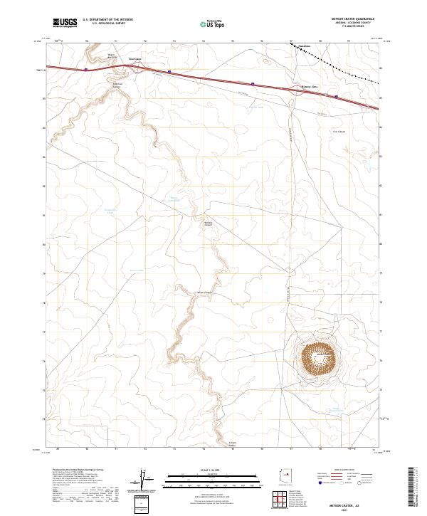
2021 Map of Meteor Crater
USGS Topo · Published 2021About this map
Meteor Crater dominates the southeastern quadrant of this Coconino County landscape, providing a striking topographic view of the world-famous impact site. The terrain is defined by deep incisions such as Canyon Diablo, Anderson Canyon, and Yaeger Canyon, which cut through the high desert plateau. Historical transportation routes are a focal point, with the alignment of Old Sixtysix and the modern interstate running parallel across the northern section. Small roadside settlements and locales like Two Guns, Rimmy Jims, and Sunshine represent the sparse human footprint in this arid region. The map details a network of water management features essential for ranching and survival, including Horse Pasture Tank, Chilson Tank, and the seasonally variable Corner Lake.
Find a feature on this map
23 named features on this map. Tap any name to fly to it.
Don’t see what you’re looking for? This feature index may not catch every label — zoom into the map to look around manually.
Map Details
Editions of this 2021 Meteor Crater Map
This is the sole edition of this map. No revisions or reprints were ever made.
Other maps of this area

1883 · Tusayan
USGS Topo · 1:250,000

1886 · Tusayan
USGS Topo · 1:250,000

1886 · San Francisco Mtns
USGS Topo · 1:250,000

1886 · Holbrook
USGS Topo · 1:250,000

1887 · Verde
USGS Topo · 1:250,000

1891 · San Francisco Mtns
USGS Topo · 1:250,000

1892 · Verde
USGS Topo · 1:250,000

1893 · Holbrook
USGS Topo · 1:250,000

1894 · San Francisco Mtns
USGS Topo · 1:250,000

1899 · San Francisco Mtns
USGS Topo · 1:250,000