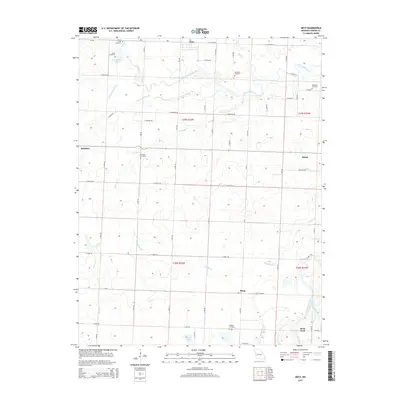
2015 Map of Metz
USGS Topo · Published 2015About this map
The Little Osage River and Marmaton River converge in this corner of Vernon County, defining a landscape marked by winding waterways and agricultural plateaus. Rural life centers around the small community of Metz, while historical hamlets like Rinehart and Blaine anchor the surrounding townships. The area is notable for its high density of family and community burial grounds, including the Pryor Creek Cemetery, Rhea Cemetery, and Summers Cemetery, which offer valuable points of reference for genealogists. Low-lying areas such as Townsend Slough and the drainage of Christian Cr illustrate the complex hydrology of the Osage basin. Further south, the map details the crossings near Dean Ford and the settlement of Hong, positioned along the path of the E Katy Track Rd, reflecting the regional significance of former railroad corridors and river access points.
Find a feature on this map
42 named features on this map. Tap any name to fly to it.
Don’t see what you’re looking for? This feature index may not catch every label — zoom into the map to look around manually.
Map Details
Editions of this 2015 Metz Map
This is the sole edition of this map. No revisions or reprints were ever made.
Other maps of this area

1884 · Fort Scott
USGS Topo · 1:125,000

1886 · Nevada
USGS Topo · 1:125,000

1886 · Fort Scott
USGS Topo · 1:125,000

1887 · Butler
USGS Topo · 1:125,000

1887 · Mound City
USGS Topo · 1:125,000

1893 · Fort Scott
USGS Topo · 1:125,000

1893 · Mound City
USGS Topo · 1:125,000

1894 · Butler
USGS Topo · 1:125,000

1894 · Nevada
USGS Topo · 1:125,000

1933 · Camp Clark
USGS Topo · 1:24,000