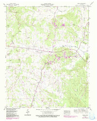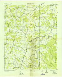
1936 Map of Michie
USGS Topo · Published 1936About this map
Michie Po and its surrounding communities in McNairy County are captured here during a period of infrastructure expansion in the mid-1930s. The map illustrates a landscape transitioning with the arrival of the TVA Trans Line and a series of transmission lines and membership divisions, reflecting the early rural electrification efforts in this part of Tennessee. Small rural centers like Acton and Chambers are documented alongside a network of family-named landmarks and essential local institutions.
Find a feature on this map
49 named features on this map. Tap any name to fly to it.
Don’t see what you’re looking for? This feature index may not catch every label — zoom into the map to look around manually.
Map Details
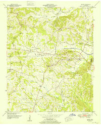
Editions of this 1936 Michie Map
This is the sole edition of this map. No revisions or reprints were ever made.
Historical Maps of Michie Through Time
8 maps found