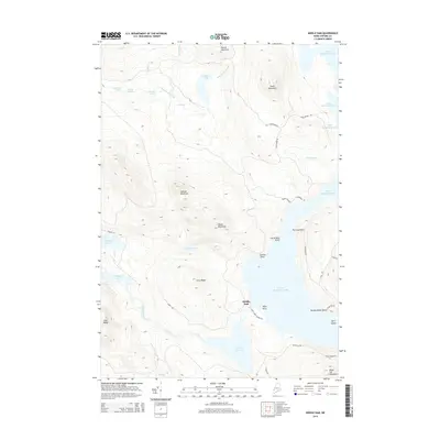
2014 Map of Middle Dam
USGS Topo · Published 2014About this map
Middle Dam sits as the central focal point of this Oxford County landscape, where the waters of Lower Richardson Lake transition into the Rapid River. The map illustrates a complex network of waterways and high peaks, including Moose Mountain and South Mountain, which define the drainage basins of the western Maine woods. Notable landforms like Portland Point and Horse Beef Point jut into the lake waters, while Hardscrabble Island and Spirit Island mark the southern reaches of the reservoir system. This survey captures the connectivity between Upper Richardson Lake and the Pond in the River, linked by established routes such as Carry Rd. The presence of several smaller bodies of water, including Cranberry Pond and Sunday Pond, tucked between ridges like Carry Ridge, highlights the intricate glacial topography of this timberland and recreation corridor near the New Hampshire border.
Find a feature on this map
45 named features on this map. Tap any name to fly to it.
Don’t see what you’re looking for? This feature index may not catch every label — zoom into the map to look around manually.
Map Details
Editions of this 2014 Middle Dam Map
This is the sole edition of this map. No revisions or reprints were ever made.
Other maps of this area

1930 · Milan
USGS Topo · 1:62,500

1930 · Errol
USGS Topo · 1:62,500

1933 · Milan
USGS Topo · 1:62,500

1934 · Errol
USGS Topo · 1:62,500

1934 · Milan
USGS Topo · 1:62,500

1940 · Oquossoc
USGS Topo · 1:62,500

1942 · Oquossoc
USGS Topo · 1:62,500

1943 · Old Speck Mtn
USGS Topo · 1:62,500

1945 · Old Speck Mtn
USGS Topo · 1:62,500

1950 · Lewiston
USGS Topo · 1:250,000