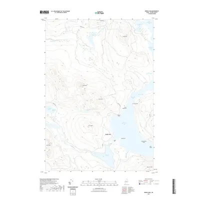
2021 Map of Middle Dam
USGS Topo · Published 2021About this map
Middle Dam sits at the vital hydraulic juncture between Lower Richardson Lake and the Pond in the River, marking a landscape defined by water management and transit. This western Maine terrain is a complex network of high peaks and interconnected basins, where the Rapid River flows westward toward Umbagog Lake. The map reveals a remote geography of named points and coves, such as Horse Beef Point and Spaulding Cove, which have served as landmarks for generations of woodsmen and lake travelers. The surrounding peaks, including Moose Mtn and Johnson Mtn, frame the deep water bodies of the Richardson chain. Tracing the shoreline from The Narrows down to Rifle Point, one can see how the natural topography dictates the few access routes, such as the Middle Dam Rd and the portage-like Carry Rd, reflecting the area's long-standing character as a sporting and timber destination.
Find a feature on this map
40 named features on this map. Tap any name to fly to it.
Don’t see what you’re looking for? This feature index may not catch every label — zoom into the map to look around manually.
Map Details
Editions of this 2021 Middle Dam Map
This is the sole edition of this map. No revisions or reprints were ever made.
Other maps of this area

1930 · Milan
USGS Topo · 1:62,500

1930 · Errol
USGS Topo · 1:62,500

1933 · Milan
USGS Topo · 1:62,500

1934 · Errol
USGS Topo · 1:62,500

1934 · Milan
USGS Topo · 1:62,500

1940 · Oquossoc
USGS Topo · 1:62,500

1942 · Oquossoc
USGS Topo · 1:62,500

1943 · Old Speck Mtn
USGS Topo · 1:62,500

1945 · Old Speck Mtn
USGS Topo · 1:62,500

1950 · Lewiston
USGS Topo · 1:250,000