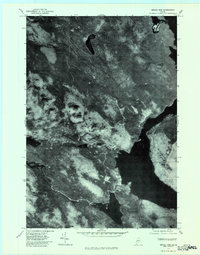
1977 Map of Middle Dam
USGS Topo · Published 1983About this map
Middle Dam serves as the focal point of this 1970s orthophotoquad, situated at the crucial junction between the expansive Lower Richardson Lake and the Rapid River. The imagery reveals a landscape defined by the water management systems of the Oxford County backcountry, where the flow from the Richardson lakes is regulated before moving toward Umbagog Lake to the west. The terrain is dominated by the massive profile of Moose Mountain, which towers over the drainage basin. Smaller water bodies like Cranberry Pond and Sturtevant Stream are visible within the dense forest cover, illustrating the complex hydrology of the Maine woods before more modern development altered these remote shorelines. This aerial perspective provides a clear view of the timberlands and water routes that have historically supported the region's logging and sporting traditions.
Find a feature on this map
8 named features on this map. Tap any name to fly to it.
Don’t see what you’re looking for? This feature index may not catch every label — zoom into the map to look around manually.
Map Details
Editions of this 1977 Middle Dam Map
This is the sole edition of this map. No revisions or reprints were ever made.
Other maps of this area

1930 · Milan
USGS Topo · 1:62,500

1930 · Errol
USGS Topo · 1:62,500

1933 · Milan
USGS Topo · 1:62,500

1934 · Errol
USGS Topo · 1:62,500

1934 · Milan
USGS Topo · 1:62,500

1940 · Oquossoc
USGS Topo · 1:62,500

1942 · Oquossoc
USGS Topo · 1:62,500

1943 · Old Speck Mtn
USGS Topo · 1:62,500

1945 · Old Speck Mtn
USGS Topo · 1:62,500

1950 · Lewiston
USGS Topo · 1:250,000