2023 Map of Middle Point
USGS Topo · Published 2023About this map
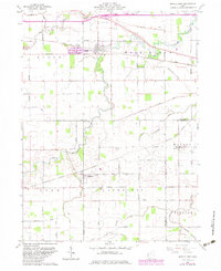
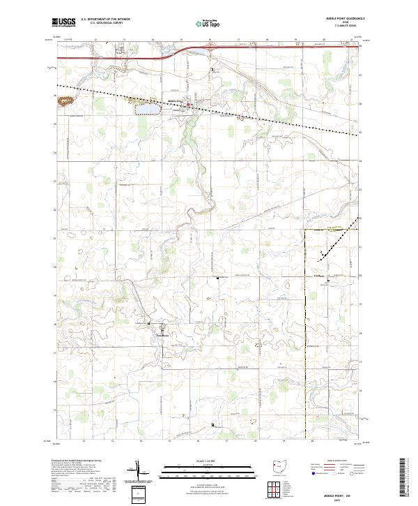
The Little Auglaize River meanders across this rural landscape in northwest Ohio, anchoring a network of small agricultural settlements and family-named homesteads. The village of Middle Point serves as a central hub, flanked by the historic Lincoln Hwy to the north and a grid of township roads. This area preserves a deep layer of local history through its scattered burial grounds, including Saint Johns Cem near Landeck and the Venedocia Cem serving the community of Venedocia in the south. The terrain is defined by the drainage of several waterways, such as West Jennings Creek and Spice Run, which shaped the early development of Van Wert and Allen counties. Genealogists can trace the intersection of established family lineages and the evolution of rural road systems like Elgin Converse Rd and Wren Landeck Rd.
Find a feature on this map
43 named features on this map. Tap any name to fly to it.
Don’t see what you’re looking for? This feature index may not catch every label — zoom into the map to look around manually.
Map Details
Editions of this 2023 Middle Point Map
This is the sole edition of this map. No revisions or reprints were ever made.