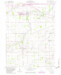
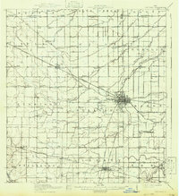
1960 Map of Middle Point
USGS Topo · Published 1983About this map
Middle Point serves as a primary rail hub on this landscape, situated where the Conrail line bisects Washington and Ridge townships. This 1960s-era geography captures the agricultural and industrial character of Van Wert and Allen counties, dominated by a grid of farm roads and the winding path of the Little Auglaize River. To the west, a large Quarry and numerous family-named landmarks like King Cem reflect the local economy and genealogy of the period. Further south, the village of Venedocia and the settlement of Landeck are anchored by their respective churches and schools, connected by the Norfolk and Western rail line. The map detail provides a clear view of the rural drainage network, including Jennings Creek and Spice Creek, essential for the region's productive farmland.
Find a feature on this map
55 named features on this map. Tap any name to fly to it.
Don’t see what you’re looking for? This feature index may not catch every label — zoom into the map to look around manually.
Map Details
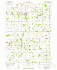
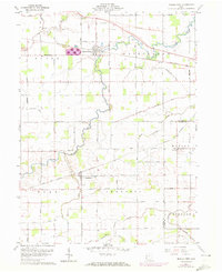
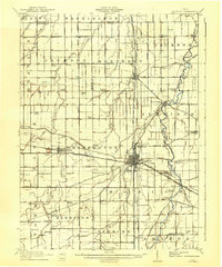
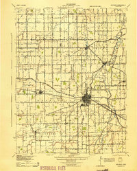
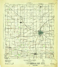
Editions of this 1960 Middle Point Map
Other maps of this area

1911 · Spencerville
USGS Topo · 1:62,500
1911 · Delphos
USGS Topo · 1:62,500

1914 · Celina
USGS Topo · 1:62,500
1914 · Van Wert
USGS Topo · 1:62,500
1944 · Delphos
USGS Topo · 1:62,500
1944 · Van Wert
USGS Topo · 1:62,500

1944 · Celina
USGS Topo · 1:62,500

1944 · Spencerville
USGS Topo · 1:62,500

1953 · Muncie
USGS Topo · 1:250,000

1956 · Muncie
USGS Topo · 1:250,000