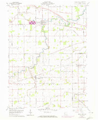
1960 Map of Middle Point
USGS Topo · Published 1972About this map
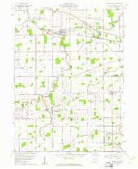
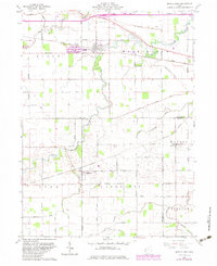
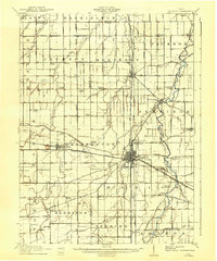
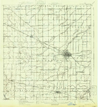
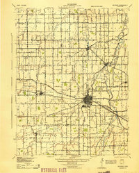
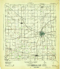
Middle Point serves as the focal point of this agricultural landscape in Van Wert County, where the village is defined by its position along the Penn Central rail line. The presence of a large Quarry just west of the town center suggests a local industrial economy rooted in the region's underlying geology. To the north, a Drive-in Theater along Spice Road marks a classic mid-century recreational landmark, while the Little Auglaize River meanders through the township boundaries of Washington and Jennings. In the southern half of the quadrangle, the community of Venedocia is surrounded by a network of family-named thoroughfares like Morgan Road and Horeb Road, which lead to historic burial sites including Horeb Cem and Wright Cem. The crossing of the Norfolk and Western railroad through Landeck further illustrates the critical role of rail transport in connecting these rural Ohio settlements.
Find a feature on this map
72 named features on this map. Tap any name to fly to it.
Don’t see what you’re looking for? This feature index may not catch every label — zoom into the map to look around manually.
Map Details
Editions of this 1960 Middle Point Map
Other maps of this area

1911 · Spencerville
USGS Topo · 1:62,500
1911 · Delphos
USGS Topo · 1:62,500

1914 · Celina
USGS Topo · 1:62,500
1914 · Van Wert
USGS Topo · 1:62,500
1944 · Delphos
USGS Topo · 1:62,500
1944 · Van Wert
USGS Topo · 1:62,500

1944 · Celina
USGS Topo · 1:62,500

1944 · Spencerville
USGS Topo · 1:62,500

1953 · Muncie
USGS Topo · 1:250,000

1956 · Muncie
USGS Topo · 1:250,000