1914 Map of Celina
USGS Topo · Published 1942About this map
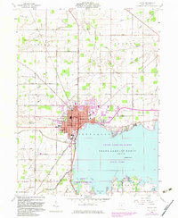
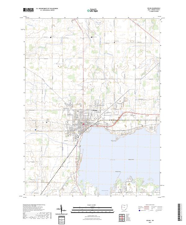
Celina sits on the northwestern shore of Grand Lake, anchoring a landscape of rural townships and rail-connected villages just before World War I. This 1911 survey shows a dense network of early transportation routes, including the Cincinnati Northern RR and the Lake Erie and Western RR, which intersect at the county seat. The rural character is defined by a striking frequency of small schoolhouses like Bevington School and Wildcat School, reflecting the era's decentralized education system. Water management is a central theme of the terrain, with the St Marys River winding through Dublin and numerous engineered features such as Prairie Ditch and Greens Ditch draining the flatlands. For researchers, the map provides precise locations for civic landmarks like the County Infirmary and the State Line border with Indiana.
Find a feature on this map
121 named features on this map. Tap any name to fly to it.
Don’t see what you’re looking for? This feature index may not catch every label — zoom into the map to look around manually.
Map Details
Editions of this 1914 Celina Map
This is the sole edition of this map. No revisions or reprints were ever made.
Historical Maps of Celina Through Time
8 maps found