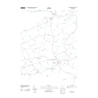
2013 Map of Middleburg
USGS Topo · Published 2013About this map
Middleburg serves as the focal point of this 2013 survey, where the waters of Middle Cr converge and Route 104 meets US 522. The landscape is defined by the parallel ridges of Shade Mountain and Limestone Ridge, which channel development into the valley floor. Small, traditional settlements such as Paxtonville, Kissimmee, and Coon Hunter are connected by a network of winding local roads like Troxelville Rd and New Berlin Hwy, reflecting an agricultural pattern that has persisted for generations. In the northern reaches, Penns Creek winds near the community of Wildwood, while the interior valleys are marked by distinctive local landmarks like Block Ore Ridge and the Roadcap Airport. This survey provides a precise account of the rural infrastructure and named terrain features that characterize this portion of Snyder County.
Find a feature on this map
110 named features on this map. Tap any name to fly to it.
Don’t see what you’re looking for? This feature index may not catch every label — zoom into the map to look around manually.
Map Details
Editions of this 2013 Middleburg Map
This is the sole edition of this map. No revisions or reprints were ever made.
Other maps of this area

1893 · Sunbury
USGS Topo · 1:62,500

1893 · Millersburg
USGS Topo · 1:62,500

1907 · Millerstown
USGS Topo · 1:62,500

1938 · Mifflinburg
USGS Topo · 1:48,000

1943 · Millerstown
USGS Topo · 1:62,500

1943 · Millersburg
USGS Topo · 1:62,500

1943 · Sunbury
USGS Topo · 1:62,500

1943 · Mifflinburg
USGS Topo · 1:62,500
1947 · Dalmatia
USGS Topo · 1:24,000

1950 · Harrisburg
USGS Topo · 1:250,000
Featured Places
- Middleburg, PA
- Perry Township, PA
- Center Township, PA
- Wildwood, Limestone Township
- Washington Township, PA