2022 Map of Midway
USGS Topo · Published 2022About this map
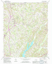
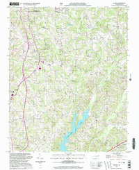
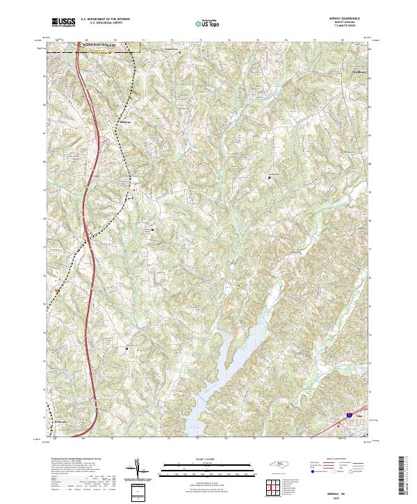
Lake Tom-A-Lex serves as a prominent focal point in this portion of the Piedmont, where the suburban reaches of Winston-Salem meet the rolling landscape of northern Davidson County. The map reveals a dense network of residential development and rural crossroads that define the modern character of communities like Midway and Wallburg. Genealogy researchers will find significant value in the documentation of local burial grounds, including the Midway Baptist Church Cem, Bethany Cem, and Bethesda Cem, which mark the historical anchors of these settlements. The drainage patterns of Abbotts Creek and its various tributaries, such as Oil Mill Br and Buck Br, dictate the local topography. This survey captures the region as it functions as a critical corridor between larger urban centers, shown through the intricate web of local roads that have replaced the earlier footpaths and farm lanes of previous generations.
Find a feature on this map
206 named features on this map. Tap any name to fly to it.
Don’t see what you’re looking for? This feature index may not catch every label — zoom into the map to look around manually.
Map Details
Editions of this 2022 Midway Map
This is the sole edition of this map. No revisions or reprints were ever made.
Historical Maps of Bethesda Through Time
3 maps found