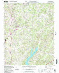
2000 Map of Midway
USGS Topo · Published 2003About this map
The rolling corridor along the Forsyth Co and Davidson Co line comes into focus at the dawn of the 21st century, anchored by the community of Midway. This landscape is defined by its deep spiritual and community roots, evidenced by the numerous country churches and burial grounds such as Hebron Ch Cem and the Midway Cem. While newer infrastructure like the Water Tank and Lookout Tower appear, the area maintains its traditional rural character through an intricate network of waterways including Abbotts Creek, Brushy Fork, and Leonard Creek.
Find a feature on this map
41 named features on this map. Tap any name to fly to it.
Don’t see what you’re looking for? This feature index may not catch every label — zoom into the map to look around manually.
Map Details
Editions of this 2000 Midway Map
This is the sole edition of this map. No revisions or reprints were ever made.
Other maps of this area

1949 · Eller
USGS Topo · 1:24,000

1949 · High Point West
USGS Topo · 1:24,000

1950 · Winston-Salem West
USGS Topo · 1:24,000

1950 · Lexington East
USGS Topo · 1:24,000

1950 · Winston-Salem East
USGS Topo · 1:24,000

1950 · Lexington West
USGS Topo · 1:24,000

1951 · Winston-Salem West
USGS Topo · 1:24,000

1951 · Winston-Salem East
USGS Topo · 1:24,000

1951 · Lexington East
USGS Topo · 1:24,000

1951 · Lexington West
USGS Topo · 1:24,000