
1950 Map of Winston-Salem West
USGS Topo · Published 1965About this map
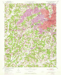
The western expansion of Winston-Salem and the rural character of Winston Twp are clearly defined in this mid-century survey. Urban density transitions from neighborhoods like Ardmore and West Highlands into the rolling countryside of Old Town and South Fork. The landscape is dotted with foundational community institutions, including Baptist Hospital, the Childrens Home, and Reynolds High Sch. Institutional and recreational landmarks such as the Forsyth Country Club and Miller Park sit alongside a dense network of local houses of worship, such as Wachovia Arbor Ch and New Philadelphia Ch.
Find a feature on this map
77 named features on this map. Tap any name to fly to it.
Don’t see what you’re looking for? This feature index may not catch every label — zoom into the map to look around manually.
Map Details
Editions of this 1950 Winston-Salem West Map
4 editions found
Other maps of this area

1949 · Eller
USGS Topo · 1:24,000

1950 · Winston-Salem East
USGS Topo · 1:24,000

1951 · Winston-Salem West
USGS Topo · 1:24,000

1951 · Winston-Salem East
USGS Topo · 1:24,000

1951 · Rural Hall
USGS Topo · 1:24,000

1951 · Walkertown
USGS Topo · 1:24,000

1953 · Charlotte
USGS Topo · 1:250,000

1953 · Winston-Salem
USGS Topo · 1:250,000

1954 · Charlotte
USGS Topo · 1:250,000

1955 · Winston-Salem
USGS Topo · 1:250,000
Featured Places
- Winston-Salem, NC
- Clemmons, NC
- South Fork, Winston-Salem
- Echo Bluff Trailer Park, NC
- West Highlands, Winston-Salem