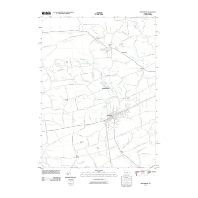
2010 Map of Mifflinburg
USGS Topo · Published 2010About this map
Mifflinburg and its surrounding agricultural valley appear in this 2010 survey, showcasing a landscape defined by limestone geology and the steady flow of mountain-fed streams. The borough stands as a central hub, while smaller hamlets like Johnstown, White Springs, and Forest Hill dot the rural interior. In the north, Rapid Run winds through the gap near the End O' Narrows Bridge, while the southern reaches are bounded by the banks of Penns Creek. Genealogists and local historians can trace family locations through sites like Long Cemetery and Lewis Cemetery, or note the recreational presence of Stone Haven Camp. The terrain is marked by the prominent Limestone Ridge, which influences the drainage of local waterways including Coal Run and Sweitzers Run, while Hoffman Airport provides a modern utility to this traditional Union County setting.
Find a feature on this map
91 named features on this map. Tap any name to fly to it.
Don’t see what you’re looking for? This feature index may not catch every label — zoom into the map to look around manually.
Map Details
Editions of this 2010 Mifflinburg Map
This is the sole edition of this map. No revisions or reprints were ever made.
Other maps of this area

1893 · Sunbury
USGS Topo · 1:62,500

1921 · Williamsport
USGS Topo · 1:48,000

1923 · Williamsport
USGS Topo · 1:62,500

1924 · Milton
USGS Topo · 1:62,500

1938 · Mifflinburg
USGS Topo · 1:48,000

1943 · Sunbury
USGS Topo · 1:62,500

1943 · Mifflinburg
USGS Topo · 1:62,500

1944 · Williamsport
USGS Topo · 1:62,500

1950 · Harrisburg
USGS Topo · 1:250,000
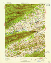
1953 · Mifflinburg
USGS Topo · 1:62,500
Featured Places
- Mifflinburg, PA
- Buffalo Township, PA
- Johnstown, West Buffalo Township
- Dice, Limestone Township
- Cowan, Buffalo Township