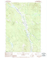
1988 Map of Milan
USGS Topo · Published 1988About this map
The Androscoggin River dominates the central corridor of this North Country landscape, carving a wide valley between the ridges of Dummer and Milan. In the late 1980s, the village of Milan serves as a hub of activity along the riverbanks, situated just north of the Berlin Airport. The terrain to the west rises toward Milan Hill and the protected lands of Milan Hill State Park, while the southwest corner reveals the industrial and natural intersection of Copperville near the Upper Ammonoosuc River. This survey captures a region defined by its timber and water resources, evidenced by the numerous mountain brooks like Chickwolnepy Stream and Stearns Brook that feed the main river. Land use here is a mix of conservation and extraction, with the White Mtn Nat Forest boundary and a Stone Quarry marking the hillsides of Berlin.
Find a feature on this map
36 named features on this map. Tap any name to fly to it.
Don’t see what you’re looking for? This feature index may not catch every label — zoom into the map to look around manually.
Map Details
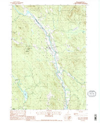
Editions of this 1988 Milan Map
2 editions found
Other maps of this area

1893 · Mt. Washington
USGS Topo · 1:62,500

1893 · Gorham
USGS Topo · 1:62,500

1896 · Mt. Washington
USGS Topo · 1:62,500

1896 · Gorham
USGS Topo · 1:62,500

1930 · Milan
USGS Topo · 1:62,500

1930 · Percy
USGS Topo · 1:62,500

1933 · Milan
USGS Topo · 1:62,500

1934 · Percy
USGS Topo · 1:62,500

1934 · Milan
USGS Topo · 1:62,500

1935 · Mt. Washington
USGS Topo · 1:62,500