1985 Map of Milbank
USGS Topo · Published 1985About this map
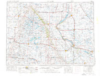
Big Stone Lake anchors this 1985 planimetric study of the borderlands between South Dakota and Minnesota. The landscape is defined by the narrow, winding waters of the Whetstone River and the Lac qui Parle River, which feed into expansive conservation areas like the Big Stone National Wildlife Refuge. Regional commerce centers on Milbank and Ortonville, connected by the legacy of the Chicago Milwaukee St Paul and Pacific and Burlington Northern railroads. A striking density of public lands, including Hartford Beach State Park and numerous National Waterfowl Production Areas, highlights the region's importance for migratory birds and water management. Smaller lakeside communities like Hiawatha Beach and Linden Beach suggest a history of seasonal recreation, while inland, the Punished Womans Lake and its associated mound provide a unique topographical and cultural reference point in the prairie terrain.
Find a feature on this map
187 named features on this map. Tap any name to fly to it.
Don’t see what you’re looking for? This feature index may not catch every label — zoom into the map to look around manually.
Map Details
Editions of this 1985 Milbank Map
This is the sole edition of this map. No revisions or reprints were ever made.