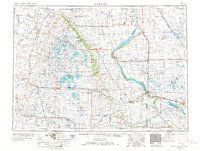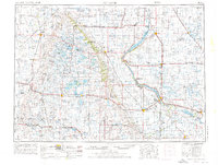
1953 Map of Milbank
USGS Topo · Published 1976About this map
The Sisseton Indian Reservation dominates the central landscape of this mid-century survey, spanning the transition between the Sisseton Hills and the massive glacial plateau known as the Coteau des Prairies. The region's geography is defined by its deep reliance on water management and conservation, evidenced by the vast Tewaukon National Wildlife Refuge and Waubay National Wildlife Refuge. Along the eastern border, the White Rock Dam and the sprawling Big Stone Lake mark the divide between South Dakota and Minnesota, where the Whetstone River and Lac Qui Parle River drain toward the southeast.
Find a feature on this map
212 named features on this map. Tap any name to fly to it.
Don’t see what you’re looking for? This feature index may not catch every label — zoom into the map to look around manually.
Map Details
Editions of this 1953 Milbank Map
3 editions found