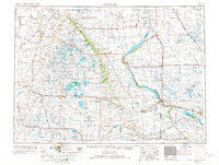
1953 Map of Milbank
USGS Topo · Published 1968About this map
The Coteau des Prairies plateau dominates this northeastern corner of South Dakota and its borders with North Dakota and Minnesota. This massive upland landform defines the regional geography, separating the rolling prairie into a complex network of glacial lakes and wetlands. Much of the central area is occupied by the Sisseton Indian Reservation, with the town of Sisseton serving as a primary hub. The landscape is dotted with prominent water bodies like Waubay Lake, Roy Lake, and the long, narrow Lake Traverse along the eastern border.
Find a feature on this map
143 named features on this map. Tap any name to fly to it.
Don’t see what you’re looking for? This feature index may not catch every label — zoom into the map to look around manually.
Map Details
Editions of this 1953 Milbank Map
3 editions found

Other maps of this area

1894 · Conde
USGS Topo · 1:62,500

1894 · Hecla
USGS Topo · 1:62,500

1894 · Oakes
USGS Topo · 1:62,500

1895 · Byron
USGS Topo · 1:125,000

1895 · Lamoure
USGS Topo · 1:125,000

1895 · Aberdeen
USGS Topo · 1:125,000

1896 · Columbia
USGS Topo · 1:125,000

1904 · Wahpeton
USGS Topo · 1:125,000

1907 · Wyndmere
USGS Topo · 1:125,000

1910 · Wendell
USGS Topo · 1:62,500