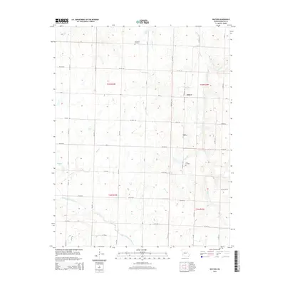
2015 Map of Milford
USGS Topo · Published 2015About this map
Milford serves as a central point in this Missouri landscape, where the agricultural grid is defined by a dense network of country roads including N Highway CC and NE 70th Rd. The region is marked by a legacy of local families and small communities, evidenced by the presence of Doylesport Cemetery, Howell Cemetery, and Cook Cemetery. This 2015 survey reveals a terrain deeply influenced by its water systems, from the larger North Fork Spring River to smaller drainages like Painter Br and Hyder Br. These waterways, along with features such as Emberry Lake and Wood Lake, show how the natural hydrology of Barton County intersects with the rural township system of t33n r30w and surrounding ranges.
Find a feature on this map
41 named features on this map. Tap any name to fly to it.
Don’t see what you’re looking for? This feature index may not catch every label — zoom into the map to look around manually.
Map Details
Editions of this 2015 Milford Map
This is the sole edition of this map. No revisions or reprints were ever made.
Other maps of this area

1886 · Nevada
USGS Topo · 1:125,000

1886 · Carthage
USGS Topo · 1:125,000

1894 · Nevada
USGS Topo · 1:125,000

1894 · Carthage
USGS Topo · 1:125,000

1947 · Joplin
USGS Topo · 1:250,000

1949 · Joplin
USGS Topo · 1:250,000

1954 · Joplin
USGS Topo · 1:250,000

1958 · Joplin
USGS Topo · 1:250,000

1959 · Joplin
USGS Topo · 1:250,000
1962 · Jerico Springs
USGS Topo · 1:24,000