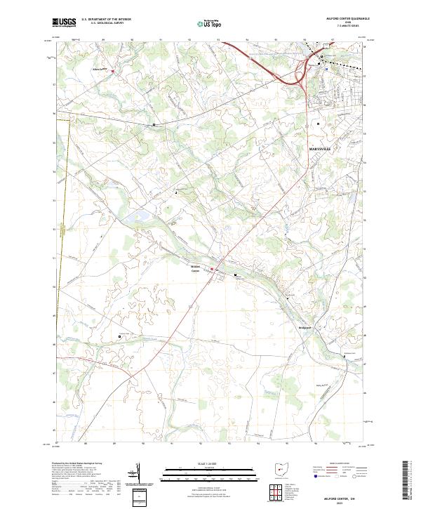
2023 Map of Milford Center
USGS Topo · Published 2023About this map
Milford Center and the western edge of Marysville occupy a landscape defined by the winding course of Big Darby Creek and its many tributaries, including Buck Run and Treacle Creek. This 2023 survey illustrates the transition from the dense street grids of Milford Center to the surrounding agricultural land, where family-named markers like McDonald Cem and Buck Run Cem remain as physical ties to the area's early farming community. Along the northern edge, the Heart of Ohio Fish and Game Association Reservoir stands as a notable water feature near the historic crossroads of Allen Center. Transportation remains a focal point, with the corridor of Milford Ave and County Highway 75 connecting the larger population centers to rural settlements like Bridgeport and landmarks such as the Darby Airport. The map also meticulously records numerous burial grounds, including Oakdale Cem and Robinson Cem, which provide essential context for local genealogical research.
Find a feature on this map
89 named features on this map. Tap any name to fly to it.
Don’t see what you’re looking for? This feature index may not catch every label — zoom into the map to look around manually.
Map Details
Editions of this 2023 Milford Center Map
This is the sole edition of this map. No revisions or reprints were ever made.
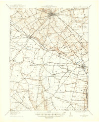
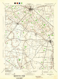
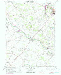
Historical Maps of Allen Township Through Time
4 maps found