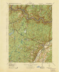
1944 Map of Milford
USGS Topo · Published 1944About this map
The Delaware River serves as the central artery for this mid-century survey, winding through the tri-state junction where Pennsylvania, New York, and New Jersey converge. The landscape is characterized by steep river bends and a high density of rural schools and small settlements that define the region's social geography before modern consolidation. Notable river hamlets like Minisink Ford, Lackawaxen, and Pond Eddy follow the water's edge, while the interior of Pike Co is dotted with isolated educational landmarks such as Dark Swamp Sch, Sawkill Sch, and Long Meadow Sch.
Find a feature on this map
82 named features on this map. Tap any name to fly to it.
Don’t see what you’re looking for? This feature index may not catch every label — zoom into the map to look around manually.
Map Details
Editions of this 1944 Milford Map
This is the sole edition of this map. No revisions or reprints were ever made.
Other maps of this area

1888 · Franklin
USGS Topo · 1:62,500

1891 · Wallpack
USGS Topo · 1:62,500

1893 · Wallpack
USGS Topo · 1:62,500

1894 · Franklin
USGS Topo · 1:62,500

1897 · Franklin
USGS Topo · 1:62,500

1903 · Franklin Furnace
USGS Topo · 1:62,500

1906 · Port Jervis
USGS Topo · 1:62,500

1908 · Port Jervis
USGS Topo · 1:62,500

1909 · Monticello
USGS Topo · 1:62,500

1911 · Monticello
USGS Topo · 1:62,500
Featured Places
- Deerpark, NY
- Lackawaxen Township, PA
- Blooming Grove Township, PA
- Montague Township, NJ
- Shohola Township, PA