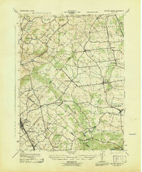
1943 Map of Milford Square
USGS Topo · Published 1943About this map
Milford Square and its surrounding townships sit at the convergence of Bucks, Lehigh, and Montgomery Counties during the mid-1940s. The landscape is defined by a dense network of small villages and crossings, with Trumbauersville and Spinnerstown serving as local hubs. The northern section of the map reveals the industrial influence of the Reading railroad and its Fogelsville Branch, which provided critical transit near Dillinger Sta. Notable for genealogists, the map preserves the exact locations of smaller hamlets such as Mumbauersville, Geryville, and Dillingerville. Significant waterways like Unami Creek and Licking Creek wind through the region, illustrating how the drainage patterns of Chestnut Hill and Hilltop shaped early settlement placements and road corridors in this part of southeastern Pennsylvania.
Find a feature on this map
48 named features on this map. Tap any name to fly to it.
Don’t see what you’re looking for? This feature index may not catch every label — zoom into the map to look around manually.
Map Details
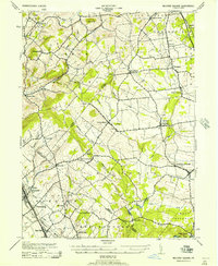
Editions of this 1943 Milford Square Map
2 editions found
Other maps of this area

1888 · Quakertown
USGS Topo · 1:62,500

1890 · Quakertown
USGS Topo · 1:62,500

1894 · Allentown
USGS Topo · 1:62,500

1894 · Quakertown
USGS Topo · 1:62,500

1902 · Boyertown
USGS Topo · 1:62,500

1902 · Slatington
USGS Topo · 1:62,500

1937 · Allentown West
USGS Topo · 1:48,000

1939 · Allentown
USGS Topo · 1:62,500

1942 · Norristown
USGS Topo · 1:125,000

1942 · Allentown West
USGS Topo · 1:62,500