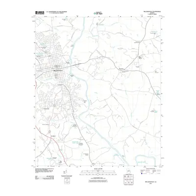
2011 Map of Milledgeville
USGS Topo · Published 2011About this map
The Oconee River carves a central path through this survey, which captures the administrative and educational center of Milledgeville. The map highlights the extensive campus of Georgia College and State University and the Milledgeville Post Office at the town's heart. To the south, the settlement of Hardwick and the agricultural surroundings of Scottsboro and The Colony indicate the persistent rural character outside the city limits. Numerous historical burial sites, including the prominent Memory Hill Cemetery and the more remote John Arnold Cemetery, provide valuable anchor points for genealogical research.
Find a feature on this map
80 named features on this map. Tap any name to fly to it.
Don’t see what you’re looking for? This feature index may not catch every label — zoom into the map to look around manually.
Map Details
Editions of this 2011 Milledgeville Map
This is the sole edition of this map. No revisions or reprints were ever made.
Other maps of this area

1912 · Milledgeville
USGS Topo · 1:62,500

1916 · Irwinton
USGS Topo · 1:62,500

1920 · Irwinton
USGS Topo · 1:62,500

1953 · Athens
USGS Topo · 1:250,000

1956 · Gordon
USGS Topo · 1:62,500

1957 · Macon
USGS Topo · 1:250,000

1958 · Macon
USGS Topo · 1:250,000

1958 · Athens
USGS Topo · 1:250,000

1959 · Athens
USGS Topo · 1:250,000

1963 · Athens
USGS Topo · 1:250,000