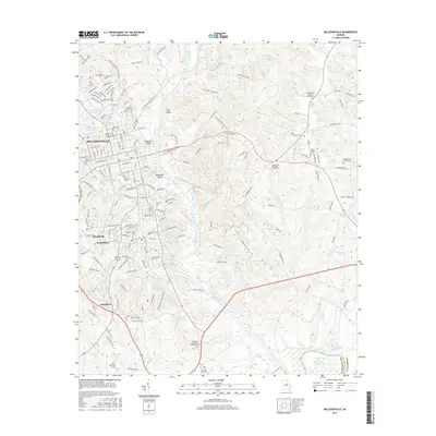
2017 Map of Milledgeville
USGS Topo · Published 2017About this map
The Oconee River serves as the central artery for this Georgia landscape, winding south past Milledgeville and creating a complex system of islands and shoals including McMillan Island, Buzzard Island, and Toms Shoals. The 2017 survey details the urban expansion of the city into neighboring Hardwick, Harrisburg, and Scottsboro, alongside several institutional landmarks. This edition is particularly valuable for genealogists, as it documents numerous historic burial sites such as Memory Hill Cem, John Arnold Cem, and the Black Springs Baptist Churchyard. Beyond the residential corridors, the map reveals a water-rich geography shaped by numerous lakes and ponds, from Lake Laurel in the north to the Georgia Lake Number Nine and Hospital Lake Number Two near the riverbanks. The southern portion is marked by the Georgia Veterans Memorial Cem and the transition into Wilkinson County, showing a landscape where residential developments give way to dense hydrology and nature centers.
Find a feature on this map
180 named features on this map. Tap any name to fly to it.
Don’t see what you’re looking for? This feature index may not catch every label — zoom into the map to look around manually.
Map Details
Editions of this 2017 Milledgeville Map
This is the sole edition of this map. No revisions or reprints were ever made.
Other maps of this area

1912 · Milledgeville
USGS Topo · 1:62,500

1916 · Irwinton
USGS Topo · 1:62,500

1920 · Irwinton
USGS Topo · 1:62,500

1953 · Athens
USGS Topo · 1:250,000

1956 · Gordon
USGS Topo · 1:62,500

1957 · Macon
USGS Topo · 1:250,000

1958 · Macon
USGS Topo · 1:250,000

1958 · Athens
USGS Topo · 1:250,000

1959 · Athens
USGS Topo · 1:250,000

1963 · Athens
USGS Topo · 1:250,000